
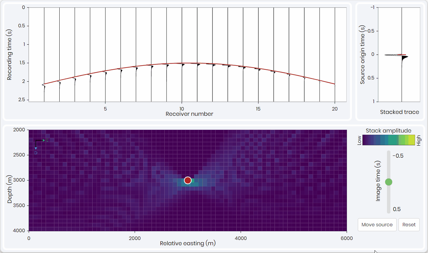
The metaKinetic platform now has a simulation under passive seismic gallery that helps understanding some of the concepts in imaging-based location without many of the complicating source and wave propagation effects present in real data. In particular the purpose of this simulation is to demonstrate the time-depth trade-off inherent in surface location procedures and demonstrate how that impacts location accuracy and array design.
“The observation of this trade-off between source origin time and source depth is at heart of understanding location resolution in surface monitoring. Since a given set of arrivals can be fit almost as well by a shallower source that happened later or a deeper source which happened earlier. Thus location depth is typically less well constrained than lateral position, because there is a trade-off between location depth and origin time.”
Kit Chambers, Scientific Advisor
With imaging-based location simulation you will get a chance to achieve:
- Familiarity with the concept of imaging-based surface location
- Understanding the relationship between image point and moveout curve
- Developing an intuition for data space and image space and their relationships
- Exploring the construction of image volumes
Want to have have access to this simulation and explore by yourself? Contact us!